We all know that maps are very helpful, not only for us to know about the world and different countries, but it is also helpful in letting us know the routes to different places. In today’s world people use the GPS facility in their phone to get directions, but it may happen that the GPS does not work, in such cases you will have to rely on the map that has been lying somewhere in your car or cupboard. To know the routes from a map, you should know how to read a map so that you get the right route and do not get lost.

Steps:
- Choose the right map: There are different kinds of maps available. Like road maps, tourist maps, topo maps for hikers, sectional maps for pilots. One needs to choose the right map before using it for the need.
- Understand the map: Most maps are drawn with north located at the top. If nothing is mentioned in the map, then assume that top is the north.
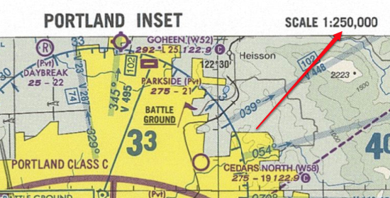
- Understand the scale of the map: The map scale shows the ratio between map distance to real distance. These differ in size from map to map. In general the following scale works well as stated: get 1:25,000 map for walking, 1:190,000 map for driving, 1:24,000,000 map for seeing the whole world.
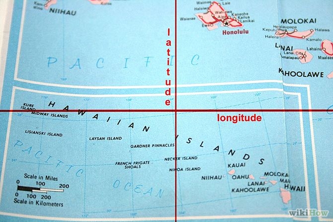
- Note the latitude and longitude
- Learn to read contour lines
- Using the map to get you from A to B: First find out where you are. First you need to figure out where you are before you plan where to go.
- Find your destination: If you just want to go from one place to the other, you need to find out that single route.
- Use the maps index: Some maps have index which tells the location of certain places
- Plot the route out
Do all the things mentioned above and you will be able to read the map with much more ease and convenience and you can reach your destination in no time.