You can pinpoint various locations on the Earth using a pair of coordinates: longitude and latitude. Longitude depicts the relative distance east or west of a north to south band called prime meridian. You can see it in maps or globes as a line running through Greenwich, England. On the other hand, latitude describes a place’s distance from the Equator. Using the two coordinates, you can pinpoint the specific global address of any place.
Before Google Maps, there are various ways for people to know about the coordinates. But it’s one great calculation you have to deal with. Back to present time, we can enjoy the benefits of Google Maps. It’s free, easy to access (as long as you have a device and internet connection) and very understandable.

Google Maps makes it easier for us to locate a certain place (or residence of a person, in fact!) as long as you have the street number, town name, zip code, municipality, province or city, and state.
Directions
- Click on this link which leads to the page of Postal Address Finder.
- Enter the address you want to view on the Maps and there it goes.
- You can use the zoom controls, particularly the zoom- in to get more specific coordinates.
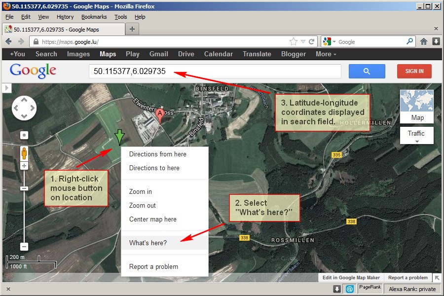
- Drag the red location pointer and place it at any point in Google Maps. You can see that there’s a sticker note-like message, informing you of the postal address along with the latitude and longitude coordinates.